
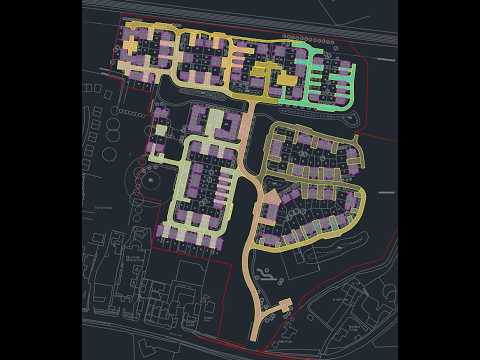
Civil engineering projects demand precision, efficiency, and seamless software integration. When designing site layouts or analyzing stormwater management systems, combining dynamic digital terrain modeling with real-world fluid dynamics is essential for successful infrastructure project delivery.
Setting Up Efficient Workflows in Civil 3D
Building a robust digital terrain model is the first critical step in any site development or grading project. Using Civil 3D, engineers can effortlessly transform raw survey points into detailed dynamic surfaces that form the backbone of their designs.
Once your ground surface is established, creating gravity pipe networks and pressure utility systems becomes significantly more intuitive. Designing corridors, alignments, and utility structures directly within the dynamic model ensures that spatial relationships and elevation controls remain accurate throughout every iteration of your project design.
Bridging the Gap with Hydraulic Analysis
While visual geometry and precision drafting are vital, evaluating how water interacts with your site is where hydraulic modeling comes into play. Seamlessly transferring dynamic pipe networks and catchment area data from Civil 3D into hydraulic analysis tools—such as Storm and Sanitary Analysis (SSA) or InfoDrainage—allows engineers to simulate storm events and optimize pipe capacities efficiently.
Setting up proper hydraulic parameters early in the modeling phase helps identify potential flooding risks, pipe surcharging, or inadequate slopes long before construction begins. Integrating these routines into a relaxed, methodical workflow leads to fewer design errors and faster project turnarounds.
Key Takeaways for Civil Designers
- Maintain Clean Surface Data: Always audit and simplify your surface contours before running complex hydraulic routines to save computational power.
- Utilize Dynamic Pipe Networks: Keep your storm and sanitary networks linked to your terrain surface so elevation adjustments reflect automatically.
- Validate Early and Often: Run quick hydraulic checks during the preliminary layout phase rather than waiting until final submittals.
By taking a structured yet adaptable approach to Civil 3D modeling and hydraulic setups, civil designers can tackle complex infrastructure challenges with confidence and ease.


