
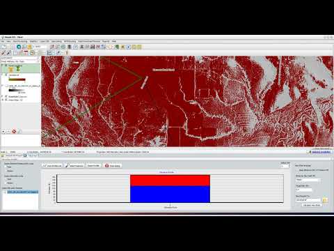
Have you ever wondered how urban planners determine optimal cellular tower locations, or how park rangers map scenic overlooks? The answer lies in viewshed analysis. In Geographic Information Systems (GIS), a viewshed analysis determines which areas of a terrain are visible from one or more specific observation points. This powerful spatial calculation relies heavily on surface elevation data, which is commonly stored and represented as a grid-based raster image.
How Viewshed Analysis Works with Spatial Data
To conduct an accurate line-of-sight calculation, GIS software evaluates terrain height across a continuous grid. When you import a Digital Elevation Model (DEM) into your workspace as a raster image, every cell or pixel contains a specific altitude value.
By defining your observer parameters—such as observer height, target height, and maximum viewing radius—the software checks the direct line of sight between the observer and every surrounding pixel. If the intervening terrain height exceeds the line of sight, that specific pixel is marked as invisible; otherwise, it is flagged as visible.
Step-by-Step: Performing Analysis in Simple GIS Client
Desktop GIS tools like Simple GIS Client make executing visibility calculations quick and accessible. Here is a brief look at the general workflow:
- Import Elevation Data: Load your surface terrain layer into Simple GIS Client. Ensure your elevation surface is properly formatted as a high-resolution raster image for accurate grid calculations.
- Define Observation Points: Place one or multiple point features on your map layout to mark where the observer is standing or where equipment is installed.
- Configure Viewing Parameters: Input key variables, including the observer's offset height above ground, vertical viewing angles, and maximum search distance.
- Execute and Review Output: Run the built-in viewshed tool. The software will generate a color-coded output layer highlighting visible versus non-visible terrain cells clearly across your site map.
Real-World Applications
Viewshed analysis is essential across numerous industries. Telecommunications companies use it to eliminate coverage dead zones, environmental planners evaluate the visual impact of proposed wind farms, and forestry teams assess visibility for fire lookout towers.
By leveraging desktop software like Simple GIS Client to process your terrain elevation data, you can transform complex spatial data into actionable visibility maps in just a few clicks.


