
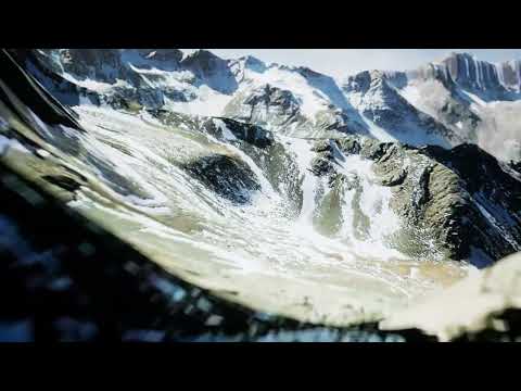
The intersection of geography and digital artistry has never been more exciting. For those passionate about environmental storytelling and technical visualization, recreating real-world landmarks in a digital space is the ultimate challenge. In this project, we explore a breathtaking 3D flyover of Mount Sneffels, a jewel of the San Juan Mountains, meticulously brought to life using a sophisticated pipeline involving GIS data, 3ds Max, and the power of the 3D Unreal Engine.
Bridging the Gap Between Data and Art
The journey begins with high-accuracy GIS (Geographic Information System) data. Unlike traditional artistic modeling, using GIS data ensures that the scale, elevation, and contours of the mountain are geographically correct. This raw data serves as the skeletal framework for the project. By importing this information into 3ds Max, the terrain is refined, and the complex geometry of the mountain’s ridges and valleys is optimized for high-performance rendering.
Enhancing Realism with 3D Unreal Engine
While the modeling starts in 3ds Max, the true magic of the visualization happens during the transition to a real-time environment. Utilizing a 3D Unreal Engine workflow allows for a level of immersion that traditional pre-rendered videos often struggle to match. Within the engine, we can implement dynamic lighting, atmospheric fog, and high-resolution textures that react naturally to the sun's position.
The result is a cinematic flyover that feels less like a computer model and more like a high-altitude drone flight. The engine’s ability to handle massive landscapes without sacrificing frame rate makes it the perfect tool for large-scale topographical projects. By leveraging the 3D Unreal Engine, we achieve a perfect balance between technical accuracy and aesthetic beauty.
A Deep Dive Into the Technical Process
This project wasn't just about clicking a few buttons; it was a rigorous exercise in technical problem-solving. From managing vertex counts to ensuring the texture maps didn't lose detail at close range, every step required a deep understanding of the software ecosystem. The flyover serves as a proof of concept for how GIS data can be transformed into educational or promotional content for hikers, geologists, and digital artists alike.
For those interested in the "nitty-gritty" details of how this was built—from the specific GIS coordinates used to the shader setups in the engine—you can find a comprehensive breakdown of the process at www.digitalanimation.net in the Featured Projects section. Be warned, however; the technical depth of this workflow is not for the faint of heart!


